How does technology improve site evaluation and construction planning?
Why Better Information Leads to Better Decisions Before Construction Begins
Construction and development decisions rely heavily on accurate information. Historically, site evaluation depended on visual inspections, paper surveys, and assumptions based on limited data. Modern technology now allows property owners and professionals to see, measure, and understand sites more clearly before construction begins.
Technology improves site evaluation by reducing uncertainty, identifying constraints early, and supporting informed planning decisions.
Site Evaluation Has Evolved
Traditional site evaluation methods often left gaps in understanding. Changes in elevation, drainage patterns, access limitations, and surrounding features were not always fully visible from ground-level inspections alone.
Modern tools now provide a more complete picture of a property before decisions are made.
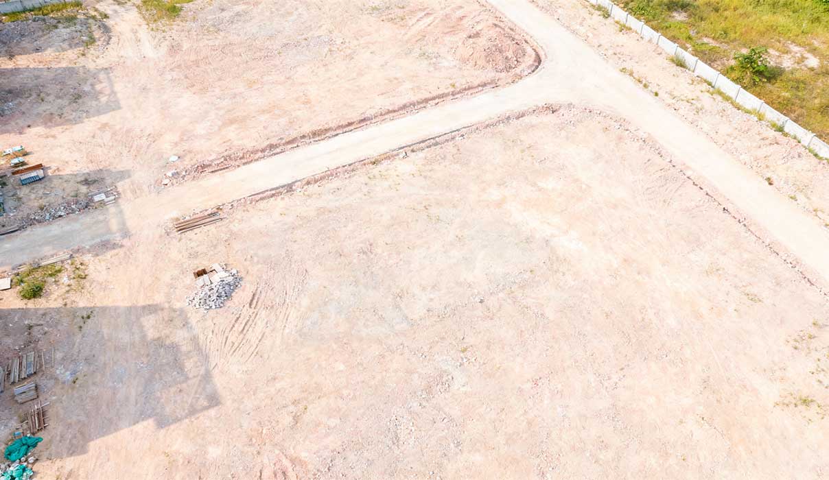
How Aerial Data Improves Site Understanding
Drone-based site evaluation allows properties to be viewed from perspectives not otherwise accessible. This helps identify:
- Natural drainage paths
- Changes in elevation
- Access routes and constraints
- Proximity to neighboring structures or features
This information supports better planning and fewer surprises during construction.
Technology Supports Smarter Planning
Accurate site data allows construction planning to be based on reality rather than assumptions. This improves:
- Layout decisions
- Site preparation planning
- Utility routing considerations
- Construction sequencing
Better planning at this stage often reduces changes later in the process.
Documentation and Record Keeping
Technology also improves documentation. Aerial imagery and digital records provide a snapshot of site conditions at specific points in time.
This documentation can be valuable for:
- Planning reference
- Communication between parties
- Progress tracking
- Resolving disputes or questions
Clear records support accountability throughout a project.
When Technology Adds the Most Value
Technology is especially useful when evaluating:
- Vacant Land
- Larger parcels
- Properties with access or topography challenges
- Sites with development potential
In these cases, visual and measurable data supports clearer decision-making.
Licensed Operation and Professional Use
In Michigan and at the federal level, commercial drone operations require proper licensing. Neil Hardcastle is a licensed drone pilot, and drone-based site evaluation conducted through PG38 Development is performed in accordance with applicable regulations.
Technology is used as a planning and evaluation tool, not as a replacement for surveys, inspections, or engineering where those services are required.
How This Fits Into Construction and Real Estate Decisions
Site intelligence informs both construction feasibility and real estate strategy. Understanding site conditions early helps property owners evaluate risk, cost, and long-term usability before committing to a purchase or construction plan.
When technology is combined with construction and real estate experience, decisions tend to be more informed and more efficient.
Final Thoughts
Technology does not replace experience. It enhances it. Tools such as drone-based site evaluation improve visibility, accuracy, and planning when used responsibly and professionally.
Better information leads to better decisions, and better decisions lead to stronger project outcomes.
FREQUENTLY ASKED QUESTIONS
Does drone evaluation replace a survey?
No. Drone imagery supports planning but does not replace a formal survey.
Is drone site evaluation legal for construction planning?
Yes, when performed by a properly licensed operator and used appropriately.
Is technology necessary for every project?
Not always, but it adds significant value in many site evaluation scenarios.